Rogelio Pardo
Program Director, Urban Movement Labs
"CurbIQ’s data collection process and platform for visualizing curb data provides public agencies with a powerful tool to manage the increasing demands for curb space in various communities in Los Angeles, as a result of new mobility options.
Tessa Williams
Business Service Analyst, Transit and Parking Strategy
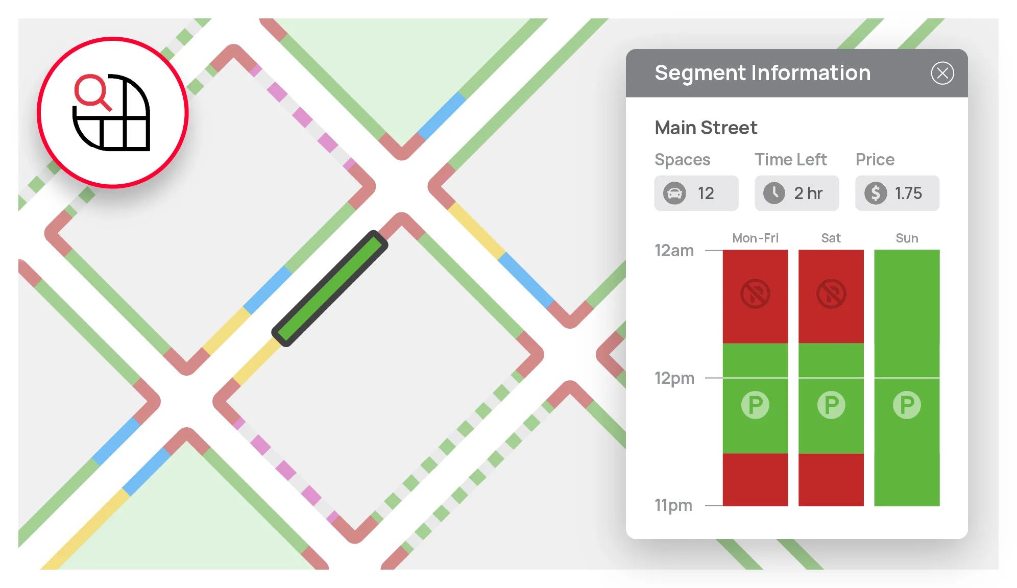
"I am using CurbIQ to gain a better understanding of existing curbside regulations, and it’s been invaluable. The Curb Viewer tool has provided detailed insight into the conflicts and gaps in existing regulations, and the visual nature of the platform has helped identify issues I didn’t even know existed.

.webp)


.webp)