Provide an interactive map embedded on event websites so attendees can locate nearby mobility options, find parking, and identify event specific locations
Provide an interactive map embedded on event websites so attendees can locate nearby mobility options, find parking, and identify event specific location
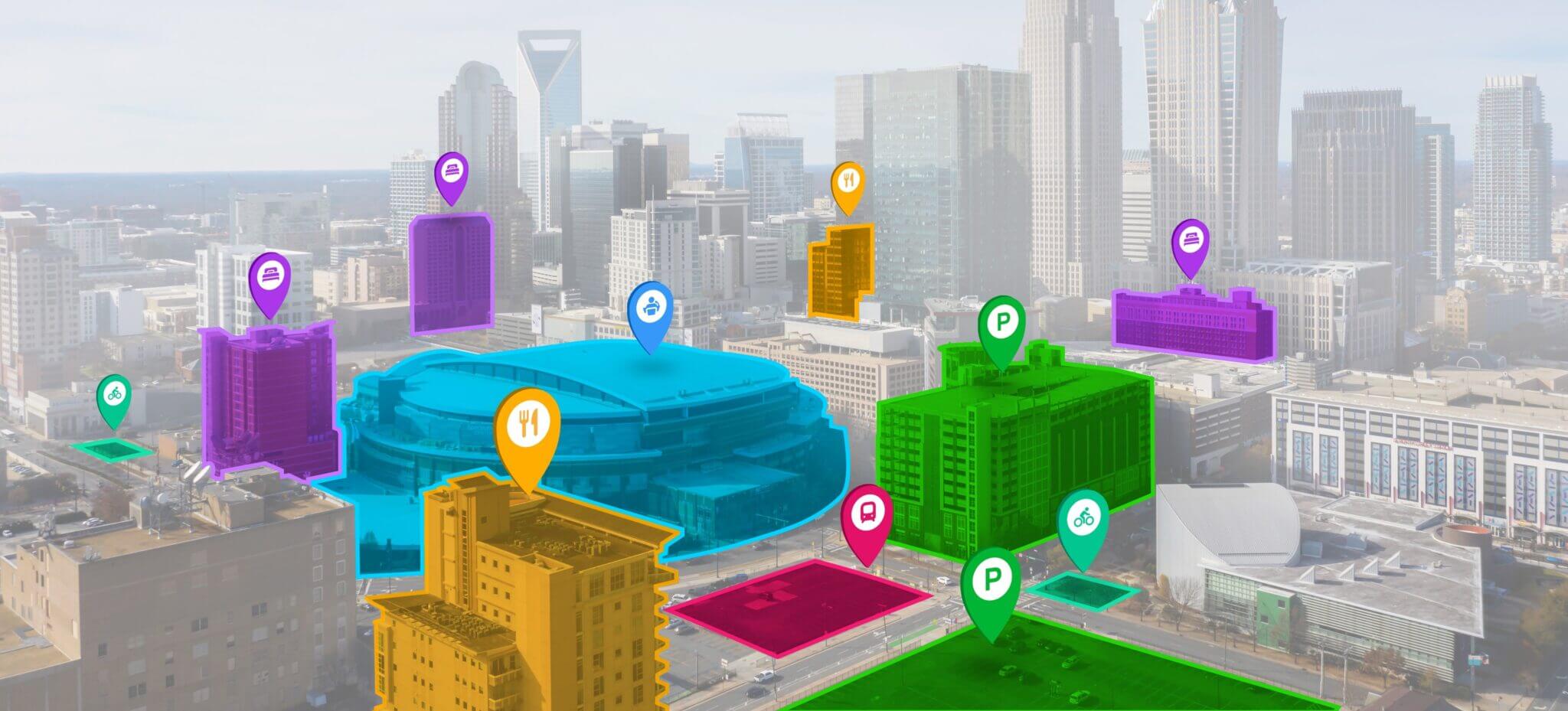
Whenever there is an event or conference happening, large crowds and heavy traffic are expected. Many events are attended by visitors from other cities, or international visitors unfamiliar with the area. Visitors and locals alike attending an event may benefit from wayfinding information on multiple mobility options, access information, event related venues, temporary street closures, pop-up spaces and more. The information is centralized in one place, on a dynamic and interactive map that can provide real time information. Understanding the various options to get to the destination allows to prioritize more sustainable modes.
The hotels and attractions around the Edmonton Convention Centre, Edmonton AB
Curbside information and parking options around CN Tower and Rogers Centre in Toronto, Canada.
The digitized and dynamic event wayfinding map can be embedded on the event website. This allows event organizers to easily communicate event information and promote the use of shared and sustainable modes of transit, and event specific information.
The event map displays alternative mobility options with real time availability & schedules, such as transit, shared mobility, bikeshare docking stations, e-scooters, car share parking, PU-DO, and more.
The event map helps identify on-street and off-street parking information around the venue with information such as rate, time limit, hours, street view, directions, and more.
The event map displays the locations of hotels, event specific locations, tourist attractions, and points of information, with all linking to external websites.
Join 2,000+ subscribers
Get insights into curbside management trends and projects.
Thank you! Your submission has been received!
Oops! Something went wrong while submitting the form.
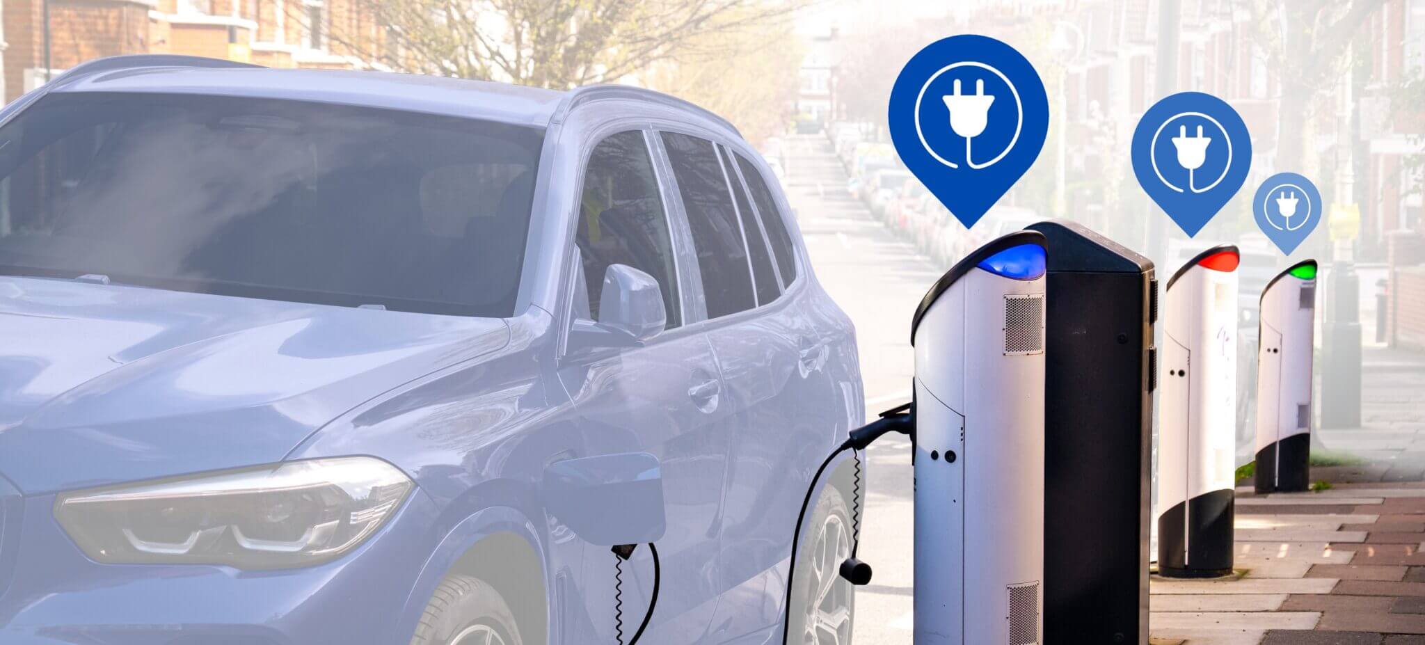
CurbIQ provides real-time data on EV-charging infrastructure for end users and enables data-driven managing and planning of city-wide EV infrastructure.
Provide an interactive map embedded on event websites so attendees can locate nearby mobility options, find parking, and identify event specific locations
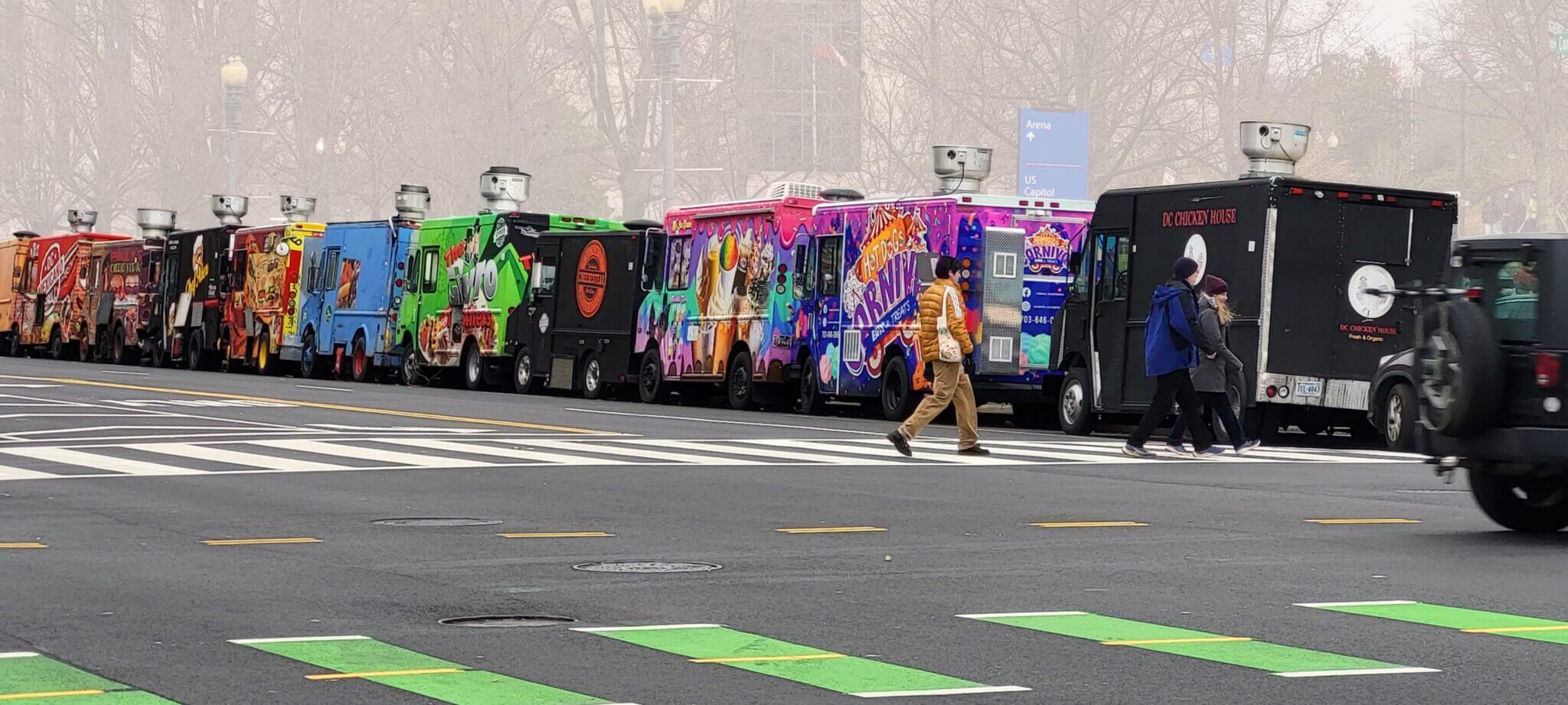
Curbside management for Food Truck e-permitting and scheduling. Dynamic management allows cities to respond to events or real-time high-demand activity.
CurbIQ’s map-based interface is a tool that can help policy makers and analysts develop, plan, track, evaluate, and report on their customized sustainability targets.